Understand Mungo
Ancient Mungo Environments
Shaping the Land
The forces that shaped the Mungo landscape over the eons are powerful, varied and ongoing. They have acted in a unique combination to create a place that has some very special qualities.
The full sweep of forces that have changed the landscape is described in The Landscape in Action, and here you can explore some of those forces in more depth.
Rivers and glaciers

The ancestral Willandra Lakes were filled by the old Lachlan River flowing down Willandra Creek. The river gathered runoff from the high slopes of the Great Dividing Range, across an area extending from near Canberra almost to the Blue Mountains. The Murrumbidgee River and the Murray River rise further south along the range, and also run out onto the western plains, but have never flowed into Willandra Lakes.
Because of the higher mountains in their catchments, with more rain and snow, the southern rivers have always gathered more runoff than the Lachlan, particularly snow-melt in the spring. The Lachlan has been a less reliable river and has not always been capable of reaching Willandra Lakes.
Only small areas of Australia were affected by glaciers in recent global ice ages. This is because the continent has been in temperate latitudes for many millions of years and has no high mountains. When the Earth's climate cools down, most of the extra ice formation happens on the colder northern continents, where vast ice sheets spread southwards over relatively low-lying land. The high mountain glaciers of the Andes, Himalaya and other temperate ranges also expanded.
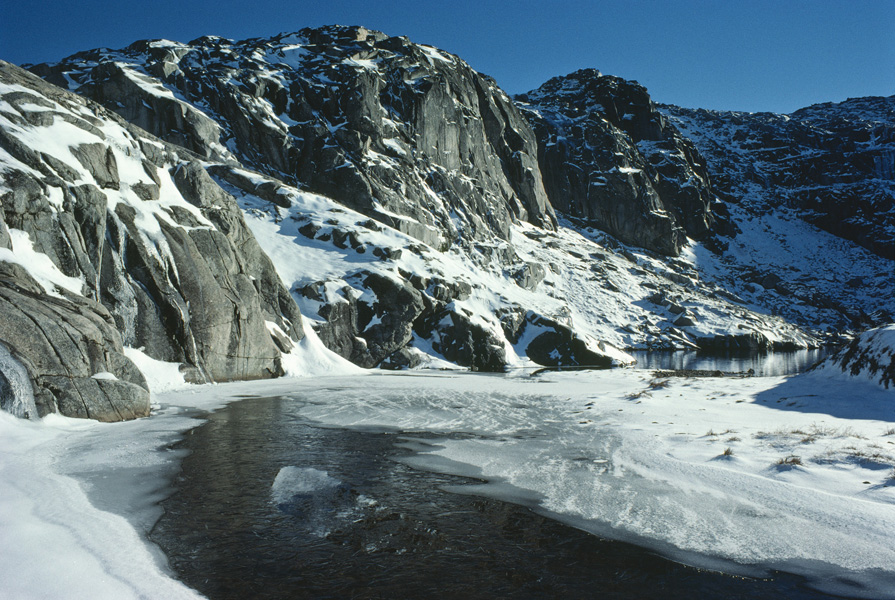
During the most recent ice age, which peaked around 20,000 years ago, several small glaciers flowed off the highest parts of the Snowy Mountains near Mount Kosciuszko (2228 metres) and on the higher peaks of New Guinea (up to 4884 metres). Ice was more extensive in Tasmania, with mountain glaciers over large parts of the Central Highlands (highest peak 1617 metres) and in the South West. The New Zealand Alps were affected even more, being further south again and with much higher altitudes (up to 3754 metres today) and snowfalls. The melted glaciers have left a visible legacy of U-shaped valleys and lake basins carved out of solid rock by the grinding ice. In the Snowy Mountains, these include Blue Lake and Lake Albina.
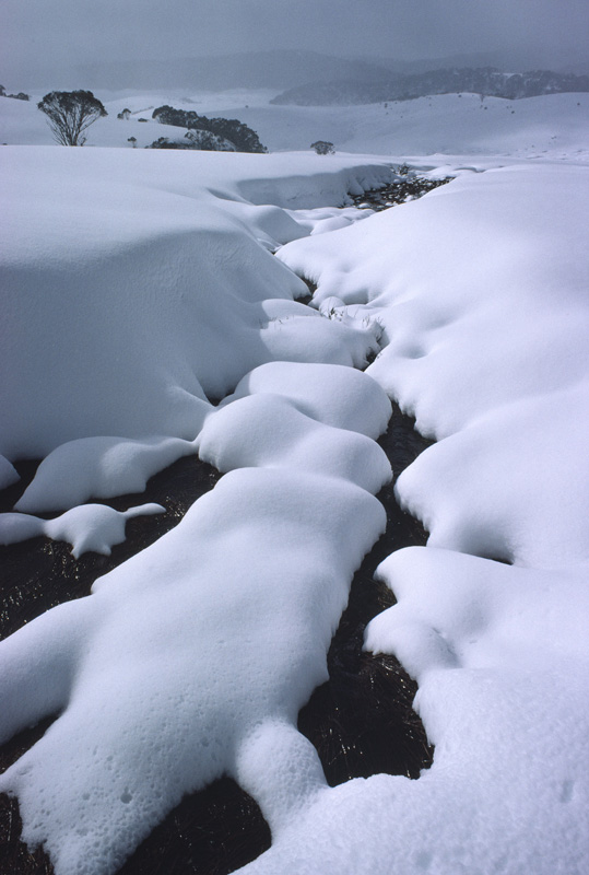
During the last glacial, a curious thing happened to the western rivers. Even though the climate was relatively arid with much reduced rainfall, the evidence shows that the rivers were bigger than they are today and ran very strongly. How could that be? Part of the answer is that the biggest flows happened in spring and summer, when the highland snows were melting back. Although glaciers occupied only a very small area, the winter snowfields were much more extensive than today. In New South Wales, the snow probably smothered the ranges at least as far north as the New England Tableland. Much of this would have melted at the end of winter, providing plenty of runoff to the rivers.
And that runoff happened more quickly too, because in the dry climate the vegetation cover was much reduced. Water runs more quickly off barren ground and infiltrates less. Geomorphologists call this 'catchment efficiency'. As a result, the western rivers 'pulsed' with seasonal floods, carrying lots of sand and gravel eroded off the bare mountains out onto the plains. The Murray, with its tributary the Murrumbidgee, flowed right through to the sea. All this water spreading out onto the floodplains and sinking in recharged the groundwater levels, which stayed high during part of the glacial period.
Because the Lachlan was smaller, it mostly failed to reach Willandra Lakes and they gradually dried up during the glacial period. As the ice age ended, something made the Lachlan change its course. It abandoned its old westward channel down Willandra Creek and took a new course running south-west, down the modern Lachlan channel. The Willandra Lakes have never filled again. Was the shift caused by windblown sand dunes blocking the channel, or maybe the piles of sediment brought down in glacial floods? More research might find an answer.
The Role of the Wind
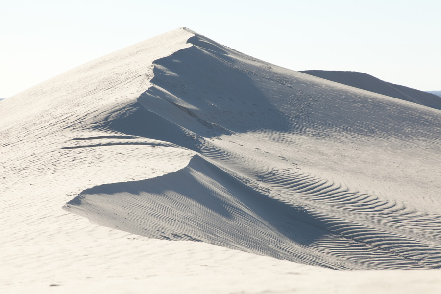
In the wide-open landscape of Lake Mungo, the wind is an almost constant presence. When you visit the Walls of China, you can see it moving sand off the lunette and across the dunes behind. The wind has been a major force in creating the landscape we see today.
The winds over the southern Australian inland have been coming mainly from the western quarter for millions of years. This has had a profound influence on the landforms of Willandra. The western winds have driven the climate, helped to create the shallow basins in which the lakes formed, blown the central Australian sand dunes towards the lakes and constructed the lunettes. The wind was a factor in evaporation from the lakes, which is an important part of the story.
Although the westerlies often carried moist air, the low ground of the western plains gathered little in the form of rain. The area is also sheltered from the east by the distant mountains, so little rain penetrates from that side. The result is a relatively arid climate, drier than the mountains and the country towards the southern coast but not as arid as the desert country to the north-west.
On the other hand, the mountains of the Great Dividing Range intercept the westerlies, forcing up the moist air and extracting rain. Especially in winter, most rain and snowfall on the Australian Alps comes from the west. This precipitation feeds the western rivers such as the ancestral Lachlan, which over the eons has supplied more water to Willandra Lakes than might be expected from their semi-arid setting.
Winds blowing across Lake Mungo and the other old lakes created waves that washed up on all the shores. On the western side of the lakes, these waves cut into the dunes that were moving in from the west, creating a steep shoreline and dumping sediment into the waters. The sediment gathered on the eastern shores where the waves were also eroding the lakeshore and building beaches. In strong winds, sand from the beaches was blown up to form lakeside dunes.
In drier times, when the lake was empty or partly dry, those same prevailing westerlies picked up clay from the lakebed and blew it onto the lakeside dunes. Layer on layer of sand and clay built up into massive lunettes, by far the largest landforms in this otherwise almost flat landscape.
Lakes, Water and Salt
The story of the Mungo landscape is a story of water and salt. Without water, the lakes would have no human history, and with no salt, the lunettes would barely exist.
But the amount of water is only part of the story, it's also about how that water is distributed in the landscape. The visible, surface water that came down the old Willandra Creek and pooled in the lakes is important, but so is the unseen water beneath the surface. Groundwater has a much wider source and reacts more slowly to changes in surface supply. The groundwater under Willandra Lakes comes partly from the rivers that flow off the eastern mountains.
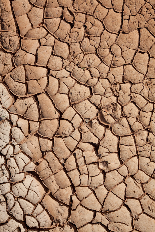
During the last glacial, when the water supply from Willandra Creek failed, the lakes were sustained at first by the groundwater level. And with colder temperatures, the water evaporated more slowly. Lake levels fell gradually, through many fluctuations, and the lakes slowly dried out through long periods when areas of the lakebeds were exposed and moist. These periods were critical to the formation of the lunettes.
Salt was critical too. Groundwater throughout the Murray Basin carries salt. As the lakes dried out, which they did many times through their history, the salt in the lakewaters became progressively more concentrated. When the lake surface fell below the groundwater level (water table), more salty water drained in to the lake from the surrounds. In the end, the drying mud on the floor of the lakes would include a high proportion of salt. Without this salt, the wind would not be capable of picking up the hard-baked clay and blowing it away onto the lunettes.
The amount of salt in the lakes was important to people too. Key food sources for the Willandra Aboriginal people included freshwater fish, yabbies and mussels. As the lakes grew saltier these resources declined and disappeared. The archaeological record provides some evidence that large fish kills provided feasting opportunities along the way.
The Lunette Story
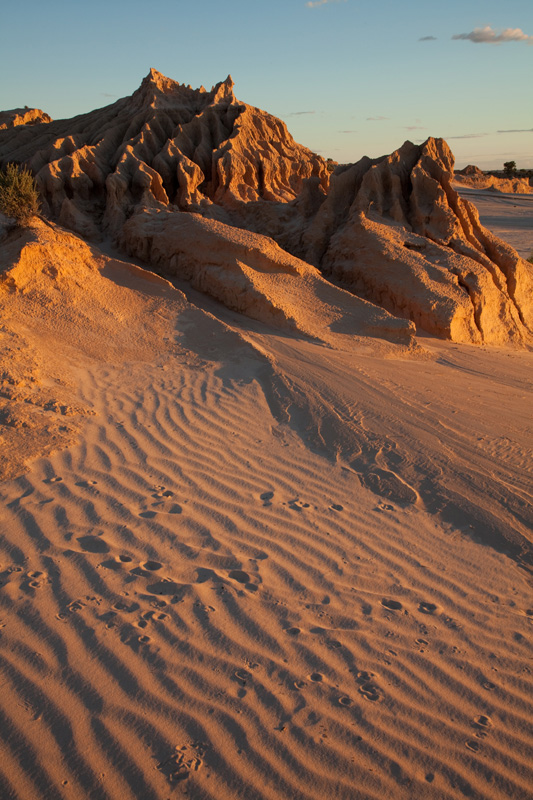
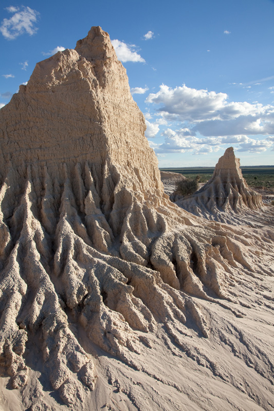
The Walls of China is the most well-known and celebrated feature in Mungo National Park. This low, curving line of sandy hills that arcs around the eastern shore of Lake Mungo is a lunette, a rather special landform that is now eroding under the rain and wind.
The name comes from the crescent moon shape of these dunes. Australia is the world centre of lunettes. Hundreds of them occur in western New South Wales alone, all with a rounded lake at their heart. Yet how they came to be there was a mystery until only about 40 years ago. The flat basins were not even recognised as fossil lakes until scientists went to look at them. After Dr Jim Bowler and others undertook careful research, it is now known that lunettes only form beside lakes in semi-arid and sub-humid areas under special conditions.
A lunette is a single, massive dune ridge formed from clay and sand blown up from the lake. In profile, lunettes look like giant speed-humps, with gentle slopes and a broad top. Some lunettes at Willandra Lakes - such as the Lake Chibnalwood lunette - show this shape clearly, but the original form of the Mungo lunette has been eroded away and is no longer so obvious.
The Lake Mungo lunette is some 20 metres high, 200 metres wide and 30 kilometres long. That's about 60 million cubic metres of dirt! All of it was blown out of this one shallow lake basin. These lunettes are the biggest features in a mostly flat Willandra landscape. Not surprisingly, they took a long time to grow.
In fact the Willandra lunettes were growing for about 140,000 years, in an intermittent, stop-start sort of way. They stopped growing after the last ice age when the lakes finally dried up because lunettes need water and salt to grow. They are now 'fossil' features from earlier times. Some modern lakes, such as those in south-western Western Australia, are still actively developing lunettes, which gives scientists a chance to see them actually forming.
A distinguishing feature of lunettes is that they are mostly composed of fine clay. The clay comes from the floor of the lake where it settles after being washed in. When the lakewaters retreat, the floor of the lake is exposed to the wind. But both damp clay and hard-set clay are difficult for the wind to pick up, which is where the salt comes in. Salt interacts with water and clay on the damp lakebed to create a fluffy, granular material of sand-sized pellets that are easily picked up by the wind.
Actual sand (silica grains), mostly from the exposed shorelines and beaches, is more easily moved by the wind and makes up a smaller proportion of the lunette. When the sediments are blown up onto the lunette, the vegetation growing there creates turbulence that slows down the wind, causing it to 'drop its bundle' of sand or clay.
The Mungo lunette has been built up slowly and progressively by the wind, laying down thin layer after thin layer over the eons until it was piled up 20 metres deep. Along the way, all sorts of material has been buried - plant remains (which have not survived), animal fossils, human remains and artefacts, shells, middens, fireplaces and more, all placed within the sediments in an orderly sequence of passing years. Some lunettes, Mungo included, became like an indexed library of vital information about past environments and people.
More recently, Mungo and some other lunettes have begun to erode. Why some and not others? It might be the different sediment composition of various lunettes. The erosion probably commenced before white settlement, but has been accelerated by overgrazing. Ironically, the erosion is continuing to expose more relics from the ancient depths of the lunette.


