My Mungo
Latest Research
Archive
- Human responses to long-term landscape and climate change in the Willandra Lakes World Heritage Area
Human responses to long-term landscape and
climate change in the Willandra Lakes World Heritage Area
a collaborative endeavour involving the Elders from the Traditional Tribal Groups from
by Dr Nicola Stern, Latrobe University
the Willandra Lakes World Hertiage Area and an inter-disciplinary research team
This project is designed to produce the first integrated account of the history of human settlement, landscape evolution and past environmental change for this unique archive of Australia's 'Ice Age' past.
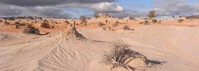
Lake Mungo is a potential treasure trove of information about the earliest settlement of the Australian continent and is renowned as the location of the world's oldest known ritual burials and the longest known trail of ancient human footprints. However, surprisingly little is known about the lives of the people who have inhabited this area for more than 45,000 years.
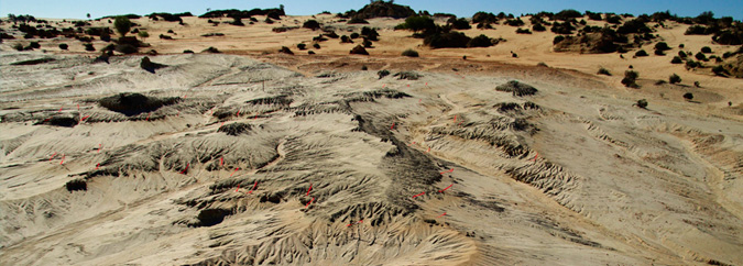
Each red flag in this image marks the location of a hearth (patches of lightly baked, ashy sediment). The 37 hearths in this cluster lie on a soil horizon that developed during a period when the adjacent lake was full of fresh water and the dunes and hinterland were vegetated and stable.
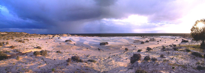
The lunette bounding the north east margin of Lake Mungo preserves hundreds of rare, snap-shot images of the remote history of these lands: hearths lit to cook a single meal of fish and wallaby, a cluster of freshwater bivalves representing a 'midday snack', and debris from the manufacture of a few stone tools. In contrast, most archaeological sites contain jumbles of debris from many different and unrelated activities that cannot be disaggregated to document the manufacture of individual tools or the contents of a single meal.
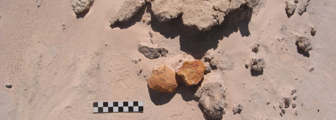
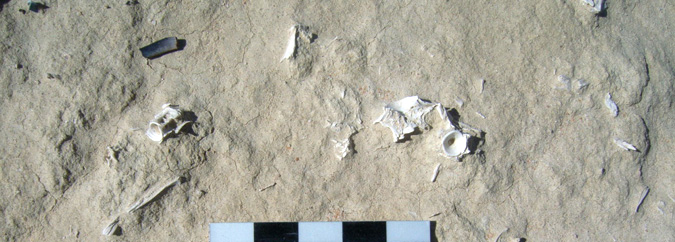
A hearth of lightly baked sediments that contains the bones of fish and a small marsupial and is associated with a scatter of stone tools struck from the same block of raw material.
This unique record offers insights into the strategies used to settle an initially un peopled and unfamiliar landscape. It also helps illuminate the technological, economic and social strategies that people devised to accommodate the long-term and dramatic changes in landscape and environment that were initiated within a few thousand years of people's arrival in the area.
The history of the Willandra region is being established by mapping distinctive layers of sediment laid down under different conditions and by establishing their age. Information about past environments is obtained from a variety of sources including stable isotope analysis of fish ear bones and mussel shells and the suite of animal bones found in both the dune sediments and archaeological sites.
Project Personnel
Dr Nicola Stern from the Archaeology Program at La Trobe University is coordinating the project and the archaeological research. Professor Colin Murray-Wallace, from the School of Environmental Sciences at the University of Wollongong, is documenting the depositional history of key lakes in the system and undertaking Amino Acid Racemization of emu eggshell and freshwater bivalves. Dr Kathryn Fitzsimmons from the Max Planck Institute for Human Evolutionary Studies in Leipzig, is an arid-land geomorphologist and OSL dating specialist who is establishing the chronological framework for the lakes being studied and documenting the context of the archaeological traces. Daryl Pappin, a member of the Mutthi Mutthi tribe, is the Project's Cultural Heritage Officer, responsible for systematic monitoring of the sites located during the archaeological foot surveys. Mungo National Park Discovery Rangers and student volunteer participate in the archaeological foot surveys. Elders from the Elders Council of the Two Traditional Tribal of the Willandra Lakes World Heritage Area accompany the researchers throughout the fieldwork to provide advice about issues of cultural sensitivity and to discuss research priorities.
The research is by funded by the Australian Research Council and supported by La Trobe University, the University of Wollongong, the Max Planck Institute for Human Evolutionary Studies, the New South Wales Department of Environment, Climate Change and Water and the Willandra Lakes World Heritage Area.
For more information: Nicola Stern, Archaeology Program, La Trobe University, + 61 3 9479 2429, n.stern@latrobe.edu.au

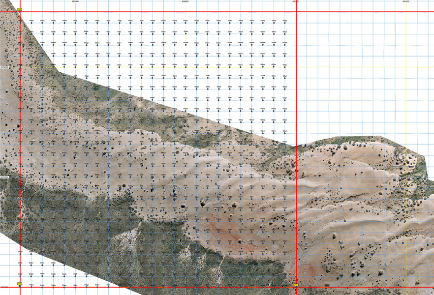
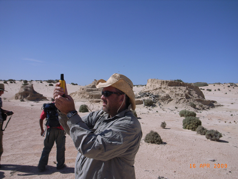
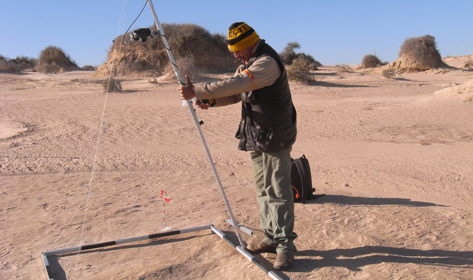
A 1.25 km grid system has been established for the Mungo Basin (left). Each 1.25 km grid square is divided into 50m x 50m grid squares that provide a framework for the systematic foot survey of the Mungo lunette (centre). The corners of each grid square are located on the ground using a GPS (right).
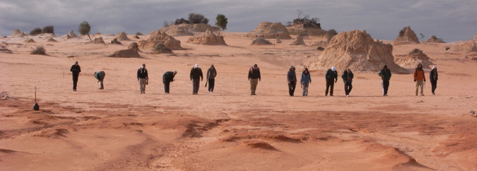
Discovery Rangers from Mungo National Park and student volunteers from La Trobe University systematically comb a 50x50m grid square looking for traces of past human activity preserved in the lunette sediments.
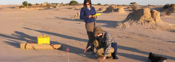
Each fireplace, midden or scatter of stone tools is documented in some detail: attributes describing their location, geological setting and content are recorded in the field using palm top computers.
Daryl Pappin, the Project's Cultural Heritage Officer, takes standardized images of hearths and middens and stone artefact scatters, to aid the monitoring of sites. Systematic monitoring allows continual assessment of the impact of erosion on features recorded during the foot surveys. This provides Elders with the critical information needed to make decisions about when and how to recover features before the information they contain is irretrievably lost to erosion.
Selected fireplaces, middens and artefact clusters are studied in detail to build a picture of the economic and technological strategies that people devised to accommodate longterm changes in landscape and environment.